Our Research
Wildlife Mortality Monitoring
Knowing the exact timing of a fatality at operating wind turbines may be one of the key pieces of data left that will help solve the mortality of bats and birds at wind turbines. With this data, we would know the exact weather conditions and time of day the event occurred, allowing researchers to make more accurate models of all mortalities. More accurate models may be able to predict the conditions that a bat fatality may occur such that, the turbine can be curtailed to stop this from happening going forward.
Wildlife Imaging Systems was awarded a Phase 1 Small Business Innovative Research grant from the Department of Energy to develop a system to accurately collect mortality data. After a successful Phase 1, a Phase 2 grant extending the development for two additional years was applied for and granted.
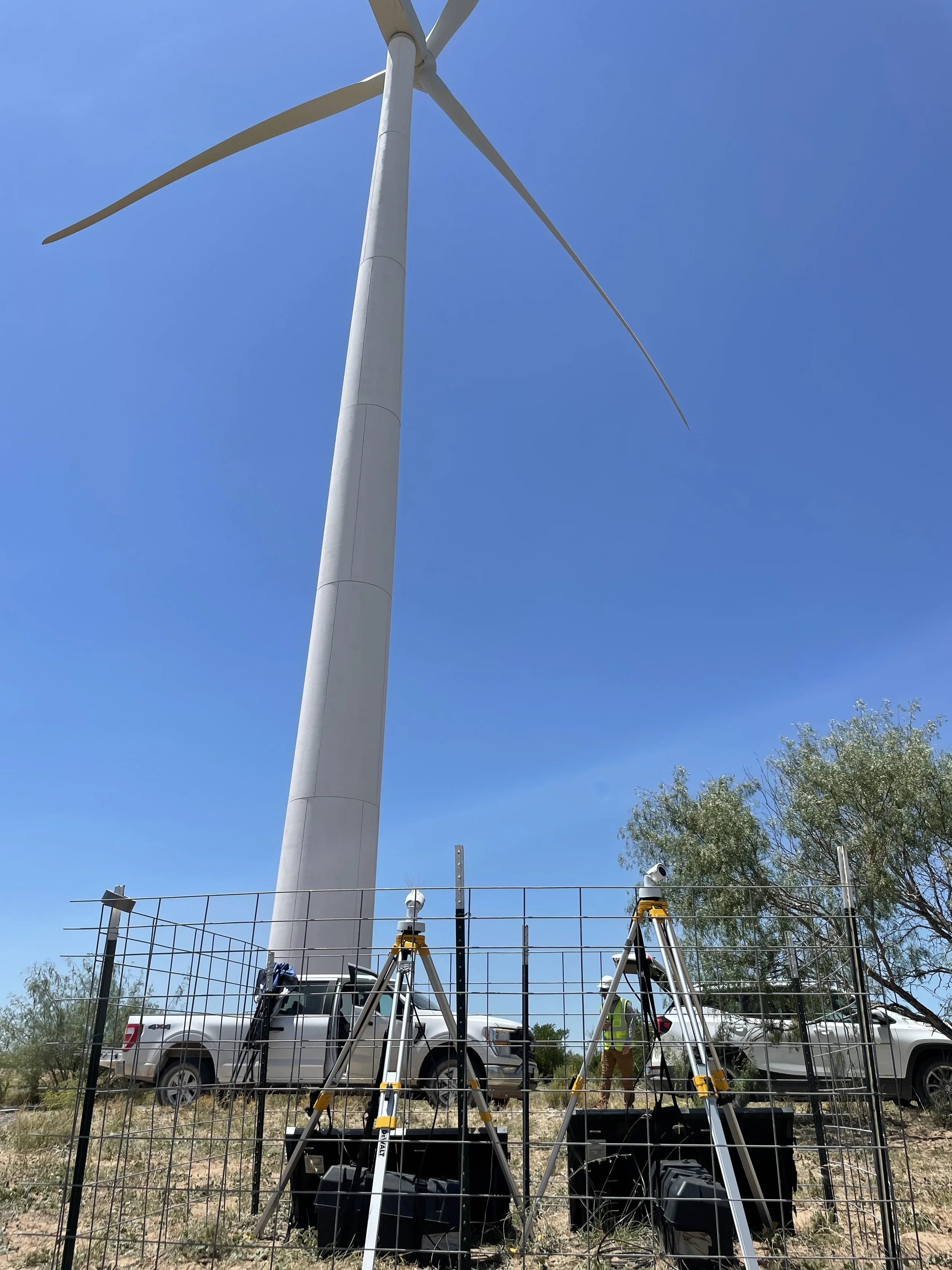
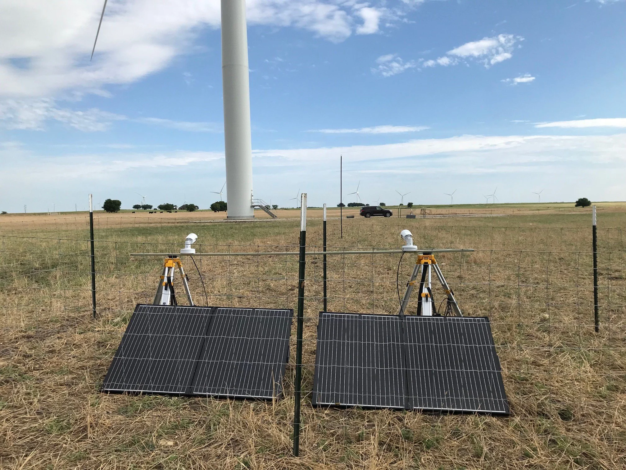
We have used this grant and developed a cost-effective system comprised of two cameras to monitor the airspace below the rotor sweep of the turbine. The two cameras are able to monitor a 100 m x 50 m area below the turbine day and night looking for objects struck by the turbine, then falling to the ground. The system has been tested over two seasons on 10 turbines throughout Texas. The initial results show that the system successfully detects falling objects going towards the ground at distances up to 100 m. We have also successfully created a model that is able to parse through hundreds of thousands of tracks to determine the few that it considers possible fatality events. More research is ongoing to refine both the detection of mortality and the machine learning model of these events.
3D Wildlife Monitoring
Wildlife Imaging Systems has received a Phase 1 and Phase 2 Small Business Innovative Research (SBIR) grant to develop a 3D tracking system using stereo thermal cameras. This is an extension of the work that we have developed that is currently monitoring the rotor swept area of onshore and offshore turbines in 2D.
The expansion to 3D is not novel, but our approach to it is. We believe that technology needs to be accessible to be useful. We are creating a system that uses two commercial off-the-shelf cameras and records video for each of them independently. Our software then takes the two video streams, processes them into detections and tracks, synchronizes them, and performs the camera-to-camera calibration needed to estimate 3D location without the need for an expensive field deployed computer. This greatly reduces the power needed for this 3D system allowing it to be deployed remotely with solar panels and batteries. It also removes the need for an extrinsic calibration target to be hoisted into the field of view of both cameras, which is difficult and expensive in onshore wind turbines and virtually impossible offshore.
When this work is completed, our system will be able to determine where an object is in space exactly. No need to estimate flight heights anymore. We will have the exact answer for you. Pairing the 3D system with high resolution visible light cameras or acoustics then allows for users to know the flight path around the turbine and possibly the species too, further refining all your inputs into a collision risk model.
Get in touch to see where we are with this work and what other applications we have in mind!